Posted on

Barnet open spaces exemplify the importance of the Green Belt

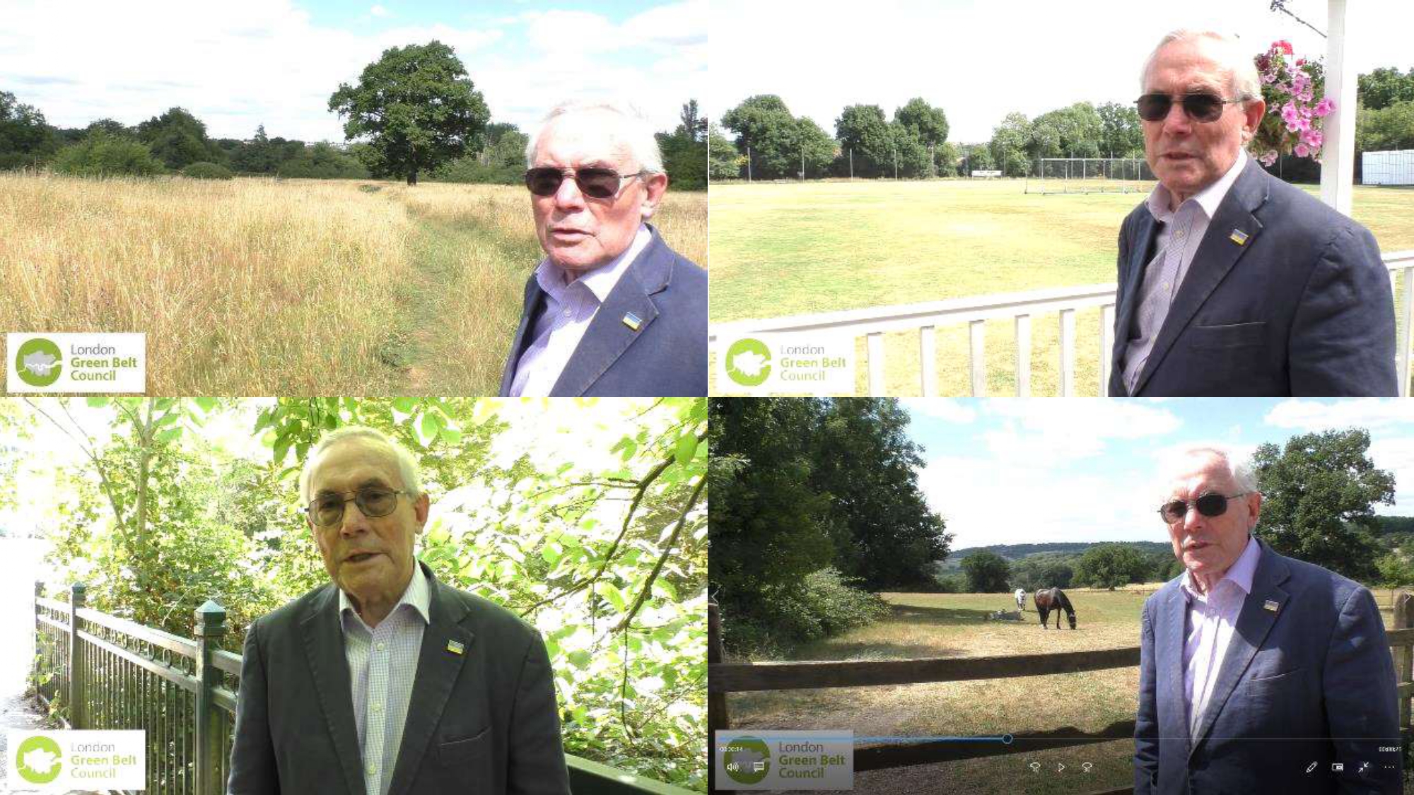
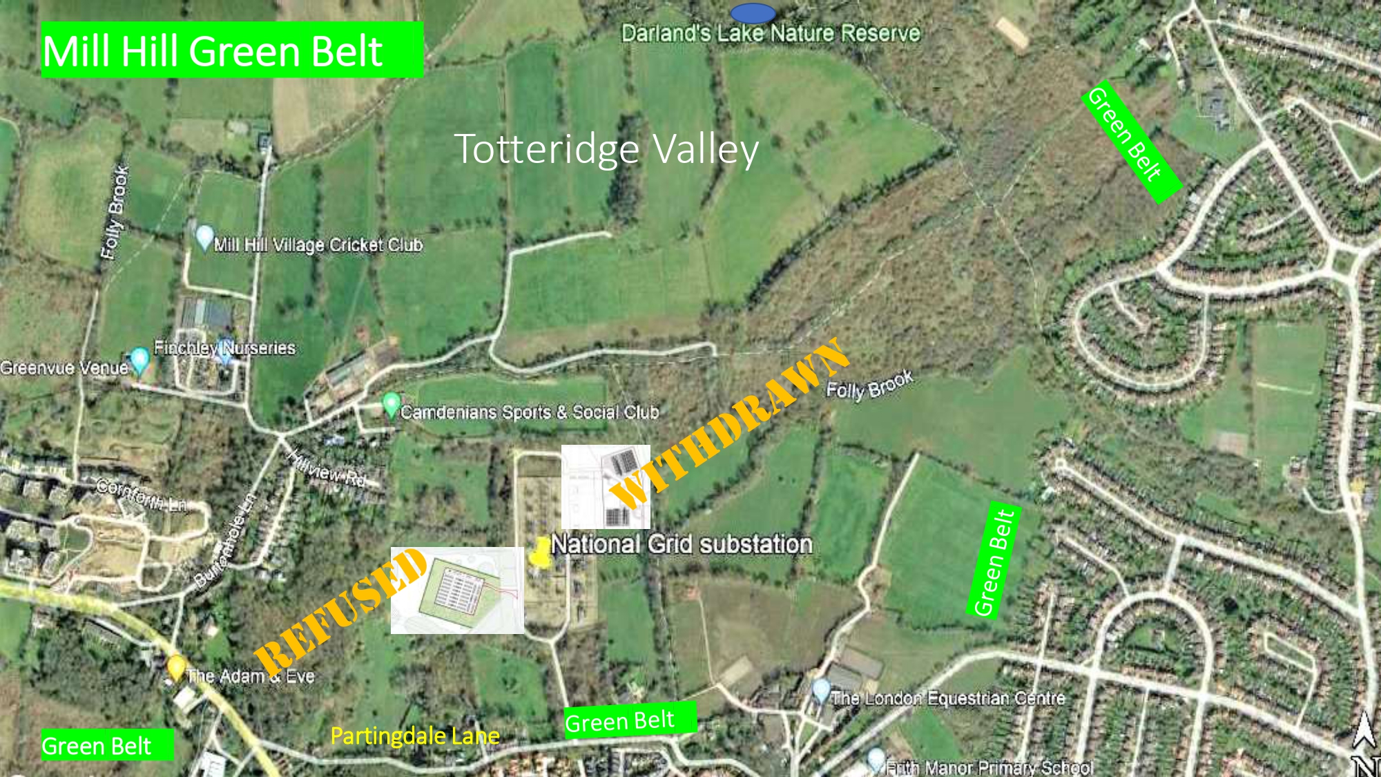
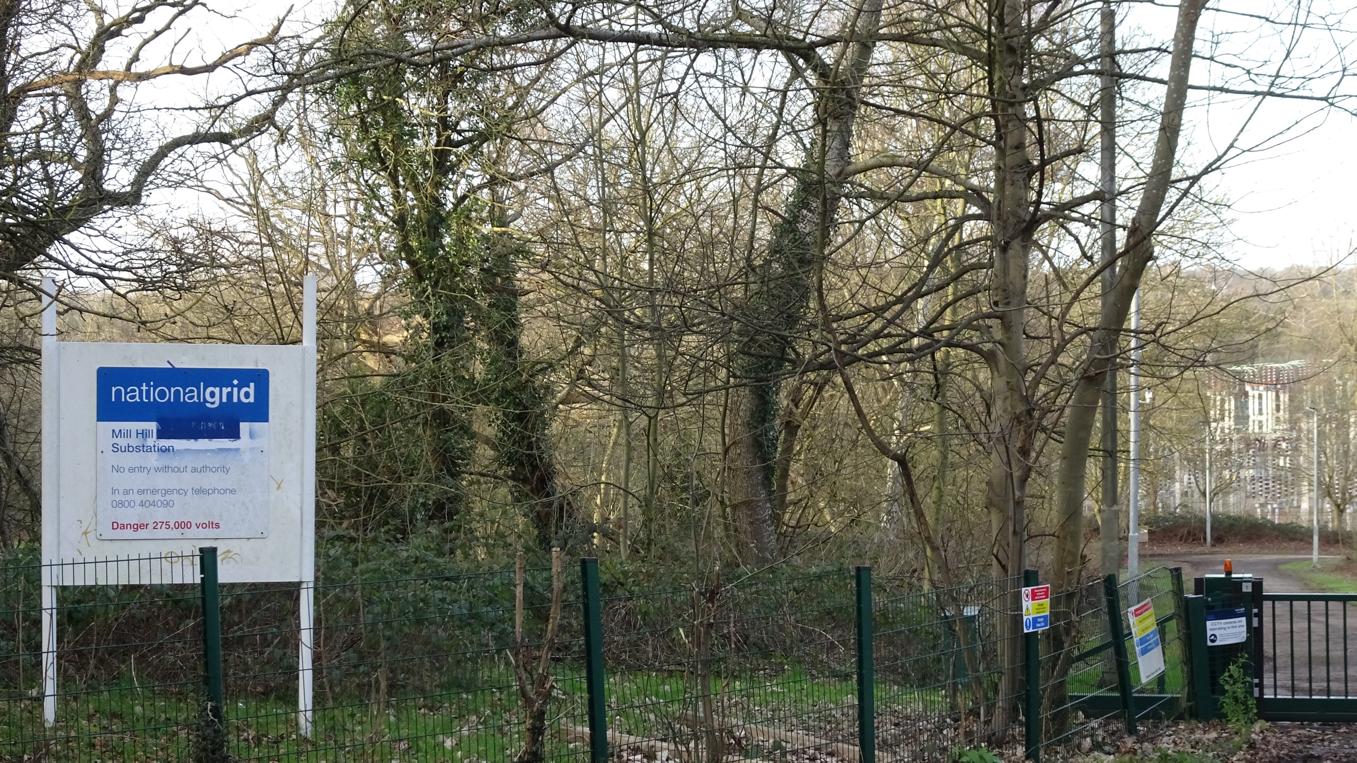
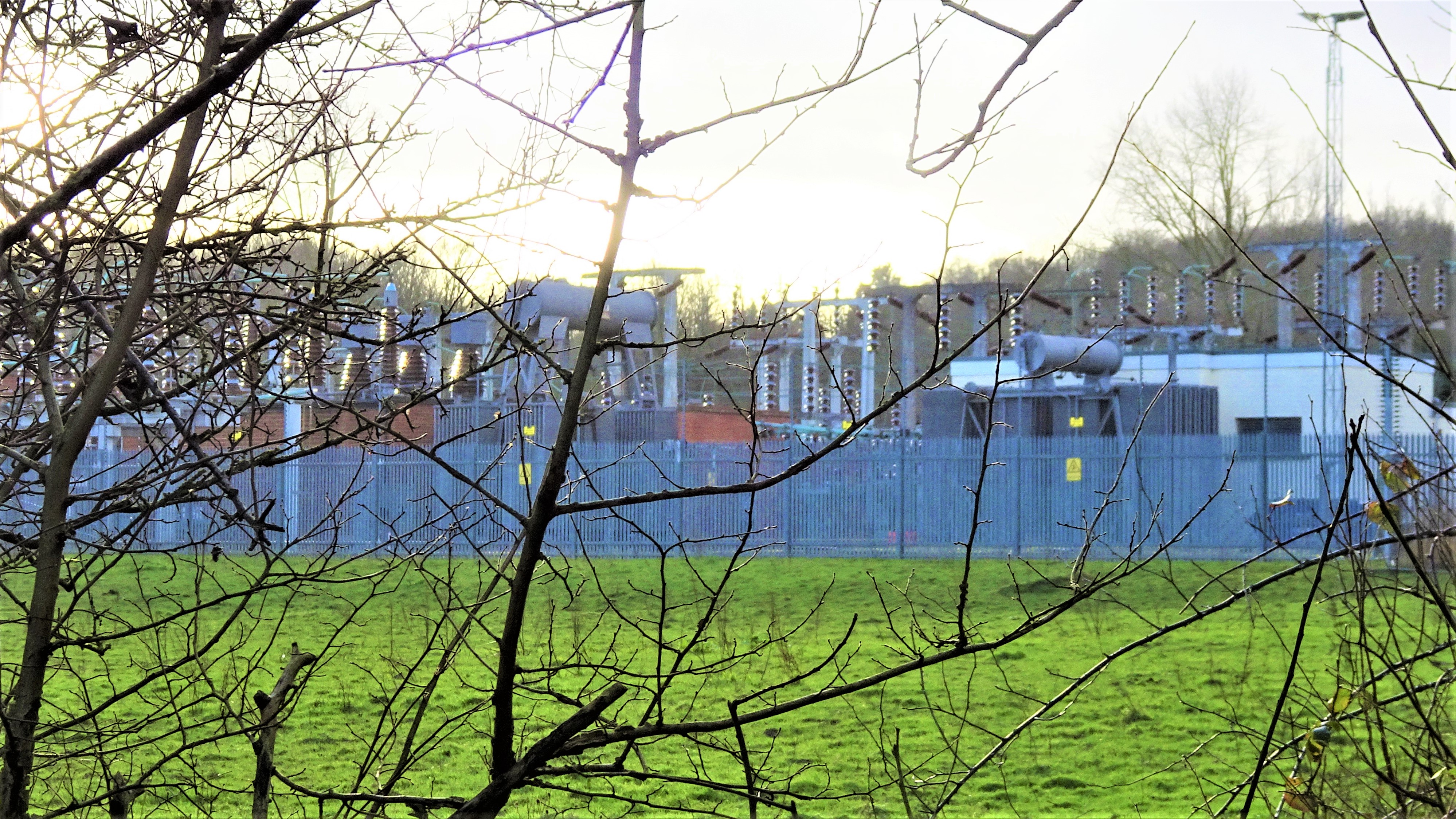
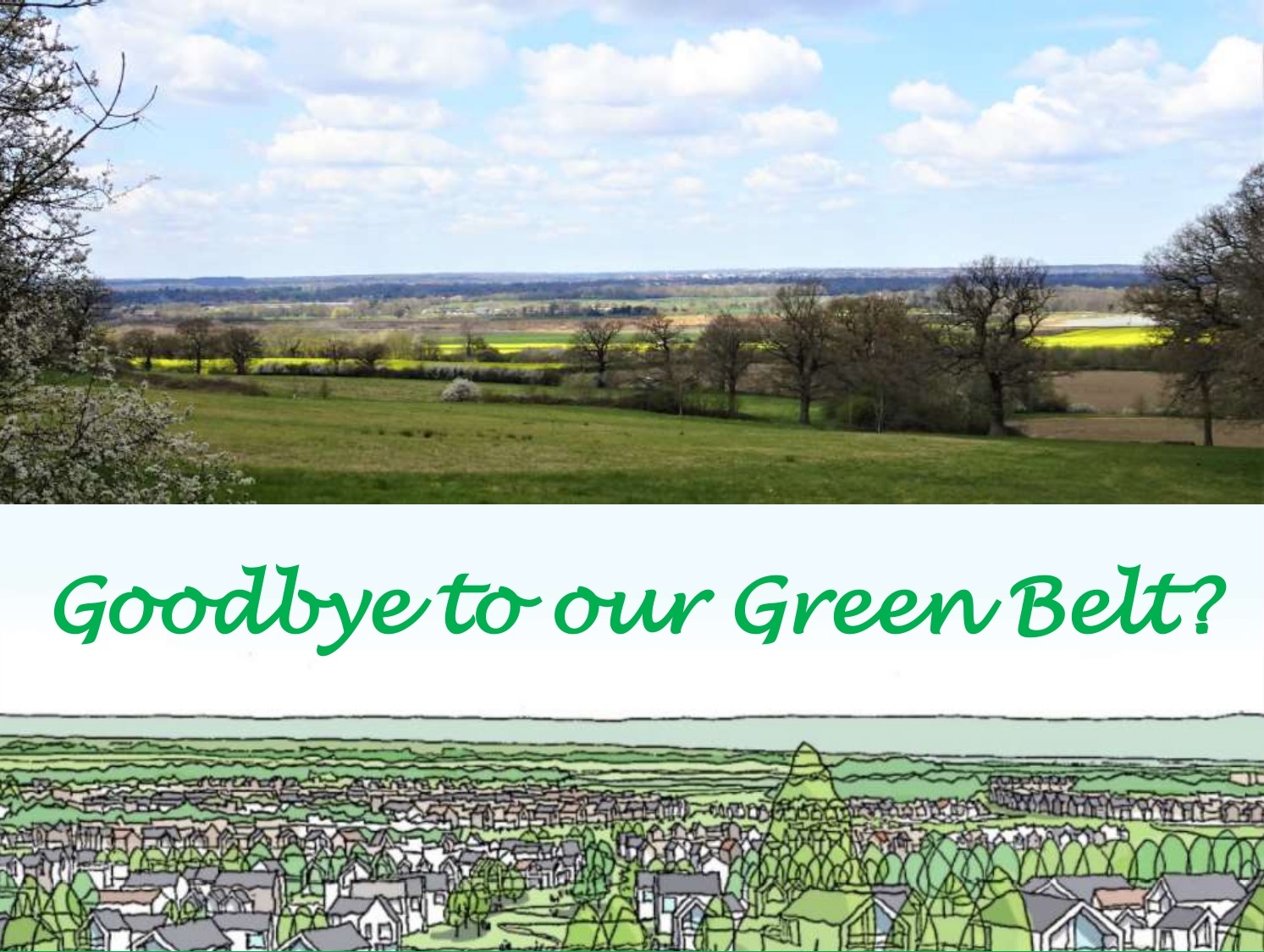
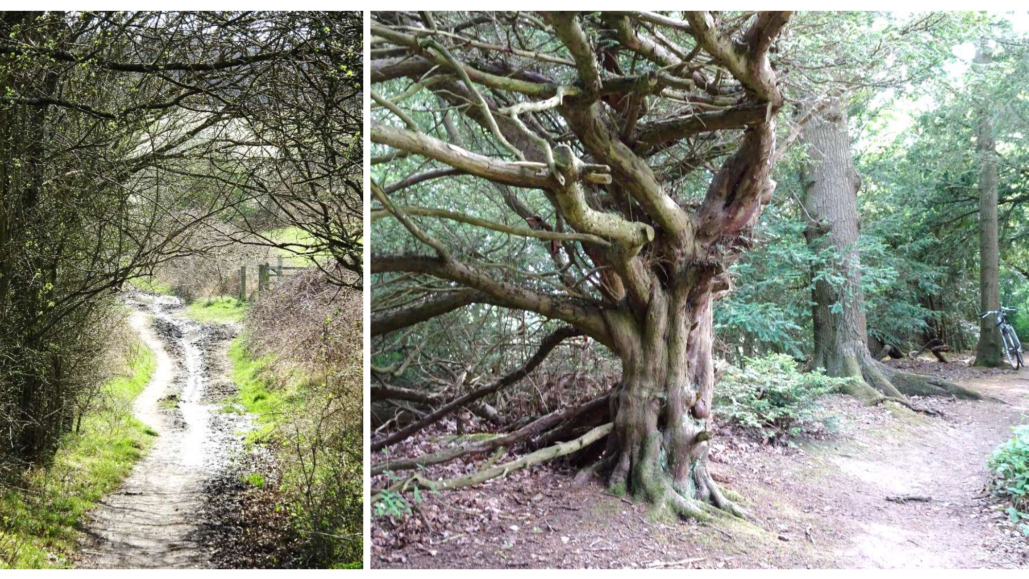
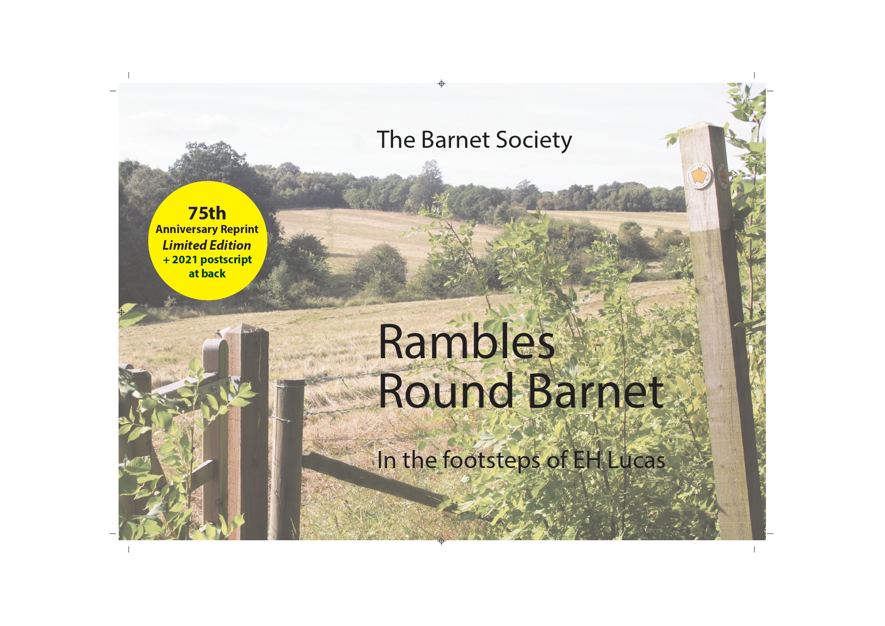
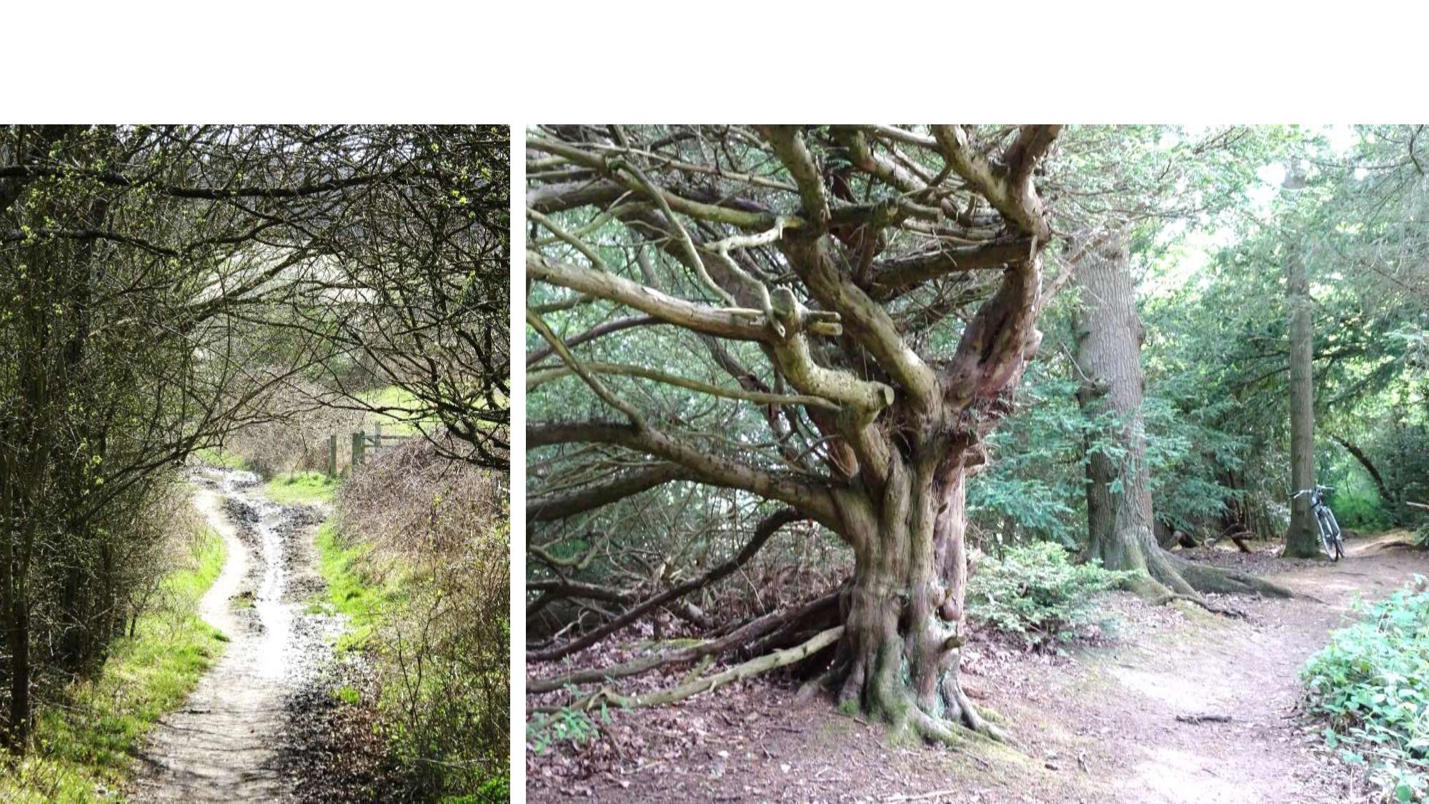
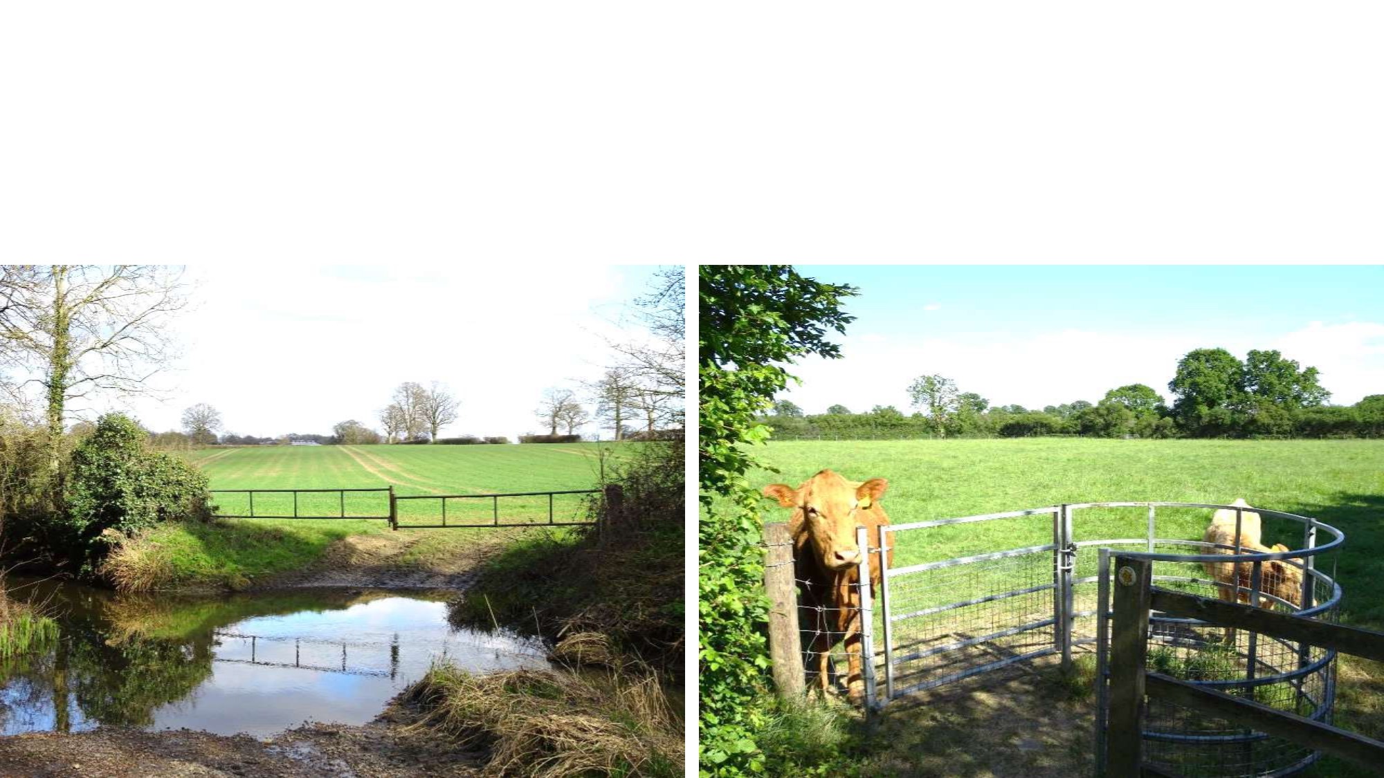
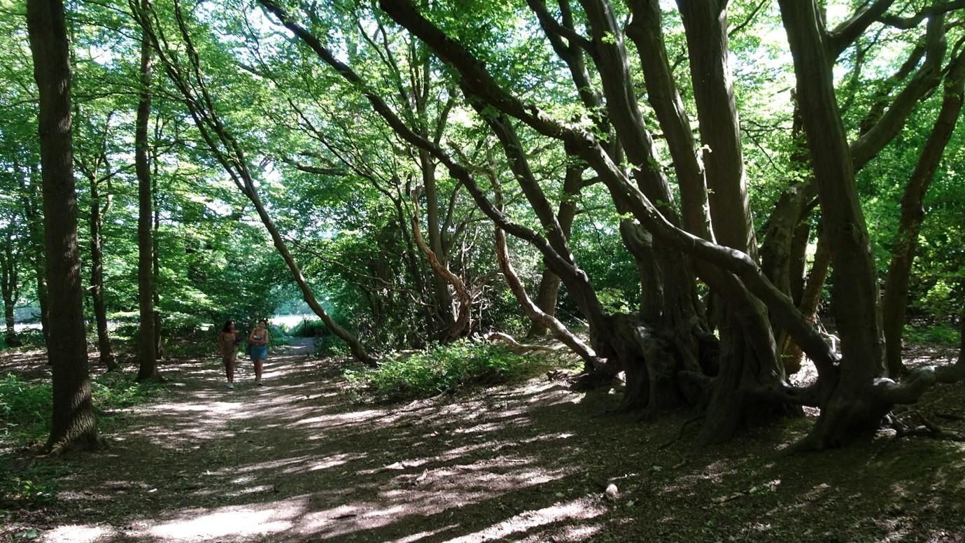
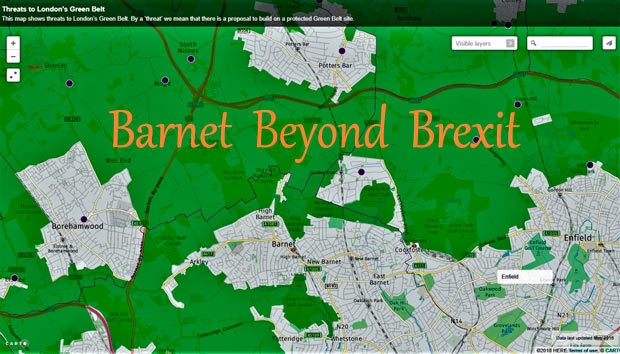
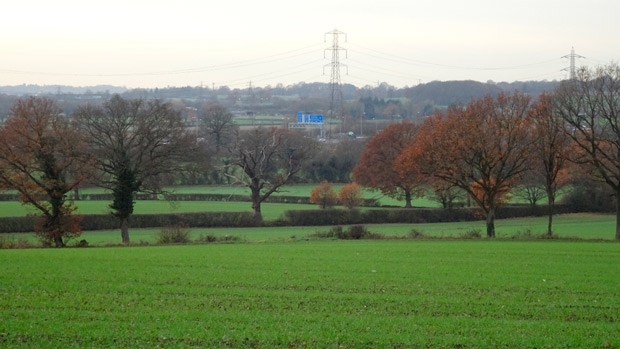
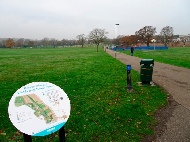
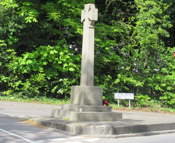
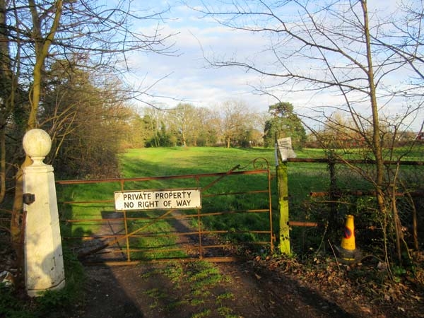
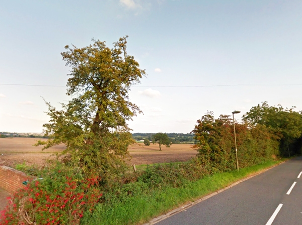
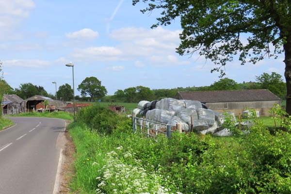
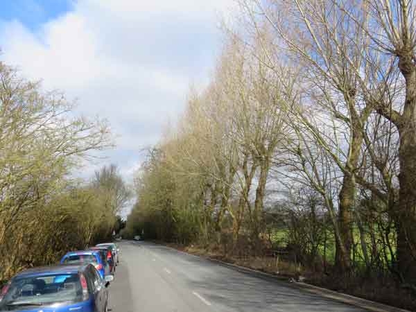
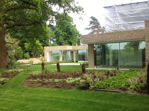
These are critical times for London’s Green Belt. But Barnet still has many open spaces where the illusion of countryside is remarkably unspoiled. Eight of them – all in Totteridge or Mill Hill – are on new videos that you can view on the website of the London Green Belt Council (LGBC).

That they survive at all is partly thanks to the Barnet Society’s efforts over eight decades. In 1945 it was founded to save the fields around Chipping Barnet from being built over for 40,000 houses. We’re longstanding members of the LGBC, which helps us fight inappropriate developments in the Green Belt – often (though not always) successfully.

In these crucial days when Liz Truss and her new cabinet have yet to confirm their policies towards the Green Belt and house-building targets, the LGBC needs to get its messages across more effectively. It has around 100 member organisations, but needs more members and a higher profile.

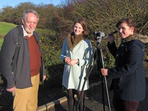
The videos are intended to raise the awareness of the public and government and recruit new supporters. In them, LGBC Chair Richard Knox-Johnston explains why retaining the Metropolitan Green Belt is so vital now for the health of both the environment and each of us. He speaks with enthusiasm and authority reminiscent of Richard Attenborough.

In Richard’s introductory clip, he says that his passion for the subject was ignited half a century ago when, as a young Bromley councillor, he represented a ward that was largely Green Belt. In the subsequent clips, he identifies key reasons for its protection:

  • Safeguarding our mental health
  • Stopping urban sprawl
  • Securing food supply
  • Providing opportunities for leisure, recreation and sports
  • Enhancing biodiversity

He concludes by demolishing the fallacy that new housing in the Green Belt is affordable.

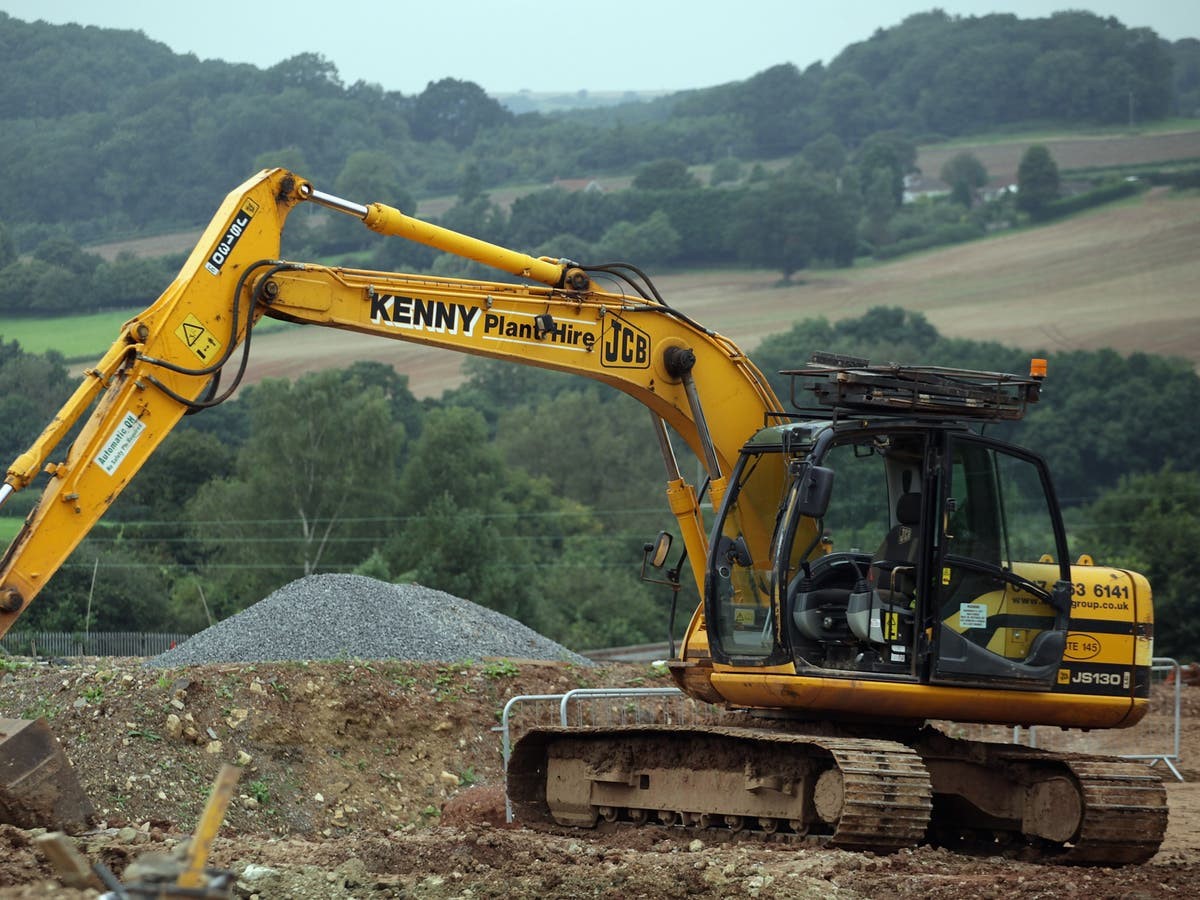
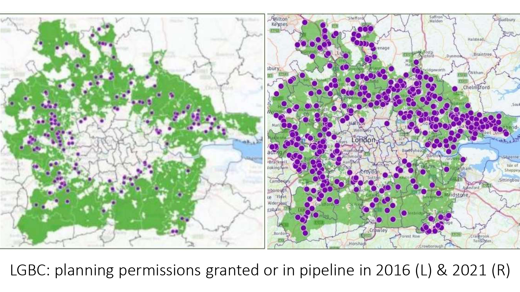
Richard’s messages are especially urgent today, when local councils in London and the Home Counties are currently planning to allow building on more than 48,000 acres of the Green Belt, according to a major new report by the London Green Belt Council (LGBC). ‘Safe Under Us’?. That’s huge: the equivalent of the combined area of the London Boroughs of Barnet, Camden and Enfield – or 60 Hampstead Heaths. You can read about the threat here.

The Green Belt is not referred to in the government’s Levelling-up and Regeneration Bill (LURB), which is working its way through Parliament. Although it’s theoretically protected by national and local government policies, ‘Safe Under Us’? shows how ineffective they are. There are also frustrating inconsistencies between government and council policies and decisions made by the Planning Inspectorate about new developments. The LURB is our best hope of bringing coherence to the planning system and reinforcing protection of the Green Belt – but it has worrying flaws and omissions that the Society, LGBC and our MP Theresa Villiers are lobbying to remove.

Enjoy the view video clips of Barnet’s eight lovely Green Belt locations without leaving your home – but even better, make the effort (if you are able) to walk them yourself!

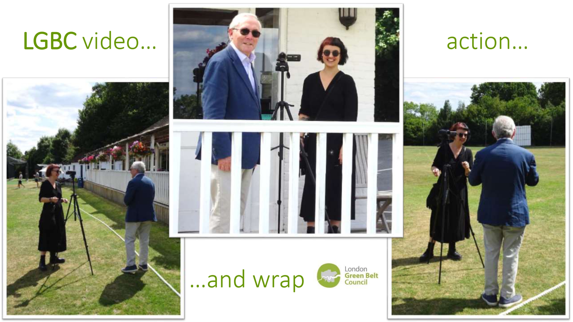
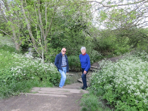
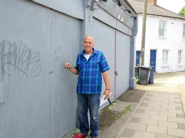
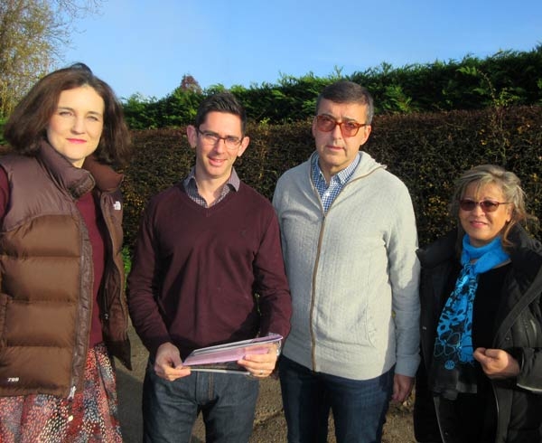
The filming went like a midsummer dream. On a perfect day (before the worst of last summer’s heatwave) I drove our small crew around the locations. Richard spoke unscripted and needed very few retakes. The videos were shot, recorded and edited most professionally by Jayd Kent of Simply Graphics.

And we found time for a nice lunch at Finchley Nurseries – in Barnet’s Green Belt, naturally.

Posted on

London is set to lose 48,000 acres of its local countryside

Local councils in London and the Home Counties are currently planning to allow building on more than 48,000 acres of the Green Belt, according to a major new report by the London Green Belt Council (LGBC). That’s huge: the equivalent of the combined area of the London Boroughs of Barnet, Camden and Enfield – or of 60 Hampstead Heaths.

It is a shocking statistic, especially when the government – including both Conservative leadership contenders Rishi Sunak and Liz Truss – claims to be committed to protecting the Green Belt. Our own MP, Theresa Villiers, has called the situation ‘very worrying’.

The report ‘Safe Under Us’? The continued shrinking of London’s local countryside, 2022 shows that altogether the amount of Green Belt land offered up for development has increased by a massive 127% since 2016, when the LGBC first started tracking threats to London’s local countryside.

Land around London began to be safeguarded from the interwar sprawl of London’s suburbs in the 1930s, and in his 1944 Greater London Plan, Patrick Abercrombie proposed a ring of greenery around the capital. In 1945 our Society was founded to protect the fields around Chipping Barnet from being built over for 40,000 houses. In 1955 the Green Belt was enshrined in planning law, leaving us surrounded on three sides by greenery (see map below).

Since then the Green Belt has been a vital ‘green lung’ for Londoners seeking respite from their urban habitat. More recently, the vital role that open countryside plays in biodiversity, flood prevention and climate change mitigation has become obvious. The Covid-19 pandemic proved its enormous value to people’s health and wellbeing. And the Ukrainian crisis reminds us of its importance for food security.

‘Safe Under Us’? details the extent of Green Belt loss under the Local Plans currently being drafted by every Council. It points out how all of the region’s housing needs could easily be met by building on brownfield (previously developed) urban sites instead. The full report can be read here.

The report highlights the fact that many councils are still using housing figures based on out-of-date (2014) population and household projections from the Office for National Statistics when more recent and accurate Census figures show a marked slowing-down of population increase. Far fewer houses are actually needed than are currently being planned for.

Furthermore, adds LGBC Chairman Richard Knox-Johnston, “It is a fallacy that building in the Green Belt will provide affordable homes. New development in the Green Belt is mainly 4 or 5-bedroom homes built at very low densities since those are the most profitable for developers to build, so not providing affordable homes for young people.”

The counties of Hertfordshire, Essex and Surrey account for two-thirds of all the current development threats. Barnet is one of the least offending planning authorities, planning to build 576 homes on a mere 133 acres of the Green Belt. Fortunately, most of these are previously-developed land in Mill Hill (the former National Institute of Medical Research and Jehovah’s Witness sites).

Despite Barnet’s policies on protecting the Green Belt and environment, however, over the last five years around 40 planning applications have been made to build on Green Belt in or near Chipping Barnet. Most are to replace existing buildings with modest residential developments, but some cause us considerable concern. They include substantial gas and electricity plants off Partingdale Lane. The former was withdrawn and the latter refused permission – but Harbour Energy has just appealed against the latter decision, so that threat remains.

And Barnet’s draft Local Plan includes a proposal for a large leisure hub in the middle of Barnet Playing Fields – which are designated Green Belt – despite similar facilities being available for community use in two nearby schools.

The Society watches such cases closely. We’re strengthened by being longstanding members of the LGBC, and of its sister organisation, the Council for the Protection of Rural England (CPRE). Several of our Committee Members are actively involved with the LGBC: Derek Epstein is its Membership Secretary, Simon Watson manages its website and I’m on its Executive Council. Derek and I contributed to ‘Safe Under Us’?.

Posted on

Green Belt reprieve from Mill Hill power plant proposals

Barnet Council has refused planning permission for a 50-megawatt electric battery array in the green heart of the borough. An earlier application for a gas peaking plant nearby was withdrawn last year. Mill Hill’s Green Belt has been saved for the moment – but if the UK is serious about reaching zero-carbon, an alternative may still need be found somewhere in the vicinity.

Tucked away on pastures north of Partingdale Lane and mostly screened by woodland is one of Barnet’s visual surprises – a National Grid substation that looks as if it recently landed from an alien planet. In fact it’s been there for years, largely unnoticed except by walkers or horse-riders. Equally surprisingly, it sits on Barnet’s Green Belt and a site of Metropolitan Importance for Nature Conservation (SINC).

The site first came to the attention of many Barnet residents in 2019, when TNEI applied to build a gas peaking plant, increasing the footprint of the substation by some 25%, on the east side of the existing National Grid plant. TNEI’s justification was that it “would help to ensure that National Grid is able to ‘keep the lights on’ in the UK as the electricity system strives to maintain the balance between supply and demand while rapidly decarbonising.” Following over 400 objections, and perhaps a rethink about gas, the proposal was withdrawn a year ago.

Meanwhile Harbour Energy had submitted another application, to install a battery storage facility including 20 battery containers (each nearly 14m long and 3m high) and 10 inverter and transformer stations, plus security fencing and other associated works, on the west side of the plant. Harbour argued that the proposed development “would store power from the Grid at times of excess supply and would feed this power back into the grid at times of high demand/reduced generation capacity.” They claimed that no other suitable sites were available in or around Barnet.

This time there were 912 objections. They included one from Theresa Villiers MP on the grounds that, although outside her present constituency boundary, the battery array would adversely affect her constituents. She and others were very concerned about nitrogen oxide emissions, air and noise pollution, and their impact on natural habitat, wildlife and ecosystems. Most were also opposed to any encroachment onto the Green Belt or SINC.

That was also the Barnet Society’s chief concern. The site is part of a wonderful tract of fields and woods that survive between Totteridge and Mill Hill, much loved by the residents who live around it and walk or ride across it.

We didn’t dispute the growing demand for energy, but battery storage and power generation aren’t listed among the ‘very exceptional circumstances’ permitted by the National Planning Policy Framework. In our view, the development would only be justifiable as part of a coherent regional energy strategy that included detailed evaluation of alternative sites, endorsed by full public consultation and political support. None of these were evident. Approval would set a damaging precedent, opening the door to ad hoc proposals on other Green Belt sites.

We therefore welcomed the unanimous refusal of the application by Barnet’s Planning Committee B on 30 March, contrary to the Planning Officer’s advice to approve it.

The conflict between our environment and our demand for energy will go on. The government’s recently-published British Energy Security Strategy is too high-level to help in situations like this. It acknowledges planning issues, but doesn’t mention Green Belts once.

The threat to the Green Belt in Mill Hill has been beaten off, at least temporarily – but it’s under attack elsewhere. As I write, a proposal has been submitted for up to nine houses on farmland by Mays Lane, and a second application is in for Arkley Riding Stables off Barnet Road (this time for three, not four, houses). And a field by Hendon Wood Lane has yet to be cleared of builder’s mess after years of illicit use as a yard. The Society can’t drop its guard.

Posted on 3 Comments

Goodbye to our Green Belt?

Above is the Green Belt between Barnet and St Albans. It’s the site of Bowmans Cross, a new settlement planned by Hertsmere Council. It will eventually have 6,000 homes for around 15,000 people – nearly as many as live in High Barnet ward. It will be a net-zero carbon, self-sustaining community, and the sketch above shows lots of trees. But if Hertsmere’s draft Local Plan is accepted, over 10% of Hertsmere’s (and also effectively Barnet’s) Green Belt will be lost forever.

Bowmans Cross is a showpiece of the Plan, which is currently out for public consultation. Another is a 63-hectare Media Quarter east of Borehamwood, which it is hoped will provide thousands of jobs. Other proposals include 2,770 houses in and around Borehamwood, 900 on the fields south of Potters Bar and 225 at South Mimms village (to list only those close to Barnet).

Good news for Barnet is that no new building is planned for the countryside south of the M25 and east of the A1. The media work opportunities will be welcome, to Barnet as much as to Hertsmere residents. But the Plan is vague about crucial details, and there’s much to cause concern:

  • Well over 10% of Hertsmere’s Green Belt will be built over.
  • At the low housing densities proposed, few homes are likely to be affordable.
  • About half of the new housing is to be built on brownfield land, but the proportion ought to be higher.
  • Little information is provided about Bowmans Cross, a new town half the size of Borehamwood and seven-tenths that of Potters Bar.
  • The economic case for a massive Media Quarter, or its long-term viability in a distributed digital age, is unexplained.
  • How Hertsmere residents will be prioritised for either housing or jobs isn’t stated.
  • Very little is said about transport, which will be vital to the Plan’s success, especially in semi-rural areas.
  • There is a potentially serious conflict with Enfield’s Local Plan over land use around M25 Junction 24.

We sympathise with Hertsmere’s predicament. It has to meet an ambitious government housing target, yet 79% of its area is designated as Metropolitan Green Belt, where development is only justifiable under very exceptional circumstances. But how hard has Hertsmere’s looked at its housing need and re-use of its brownfield land?

Its housing target is for a minimum of 760 new homes a year, or at least 12,160 homes by 2038. That’s based on the South West Herts Local Housing Needs Assessment, which appears not to have been challenged. Those who’ve been following the U-turns in the government’s proposed planning reforms will wonder how robust such figures are. The results of the 2021 Census are urgently needed to substantiate predictions of continuing population growth in the South-East, post-Brexit and post-Covid.

There’s also the question of whether Hertsmere’s houses will meet its own needs. It’s not explained how existing local residents will be prioritised. New homes near Barnet are almost certain to be cheaper and more spacious, internally and externally, than in Barnet itself. They’re bound to attract young couples and families struggling to afford property in our area. It would be ironic if much of Hertsmere’s new housing ended up benefitting Londoners at the expense of its own residents.

A further doubt surrounds affordability. The Plan says that 35% of new homes will be affordable, but CPRE research shows that only a tenth of homes built in the Green Belt are affordable, and these are rarely for social rent.

The Plan says, “The strategic green belt will be protected…and improvements made to the countryside and biodiversity to offset the impact of development.” That glosses over the fact that at least 10% of Hertsmere’s present Green Belt will be sacrificed to the developments listed above. Across the borough, the total will be greater, but the Plan is silent about the figure.

It‘s unclear how rigorously Hertsmere has investigated the alternative of re-using brownfield land. Table 3 in the Plan claims that 6,020 new homes – nearly half of its 15-year total requirement – would be on urban sites. According to its Table 2, 2,765 of such sites are available excluding smaller villages/hamlets, which seems scarcely credible. If true, it’s good news, but no brownfield register is mentioned to substantiate it.

If that brownfield land were to be redeveloped at densities equivalent to, say, the award-winning Newhall in Harlow – i.e. no more than four stories high, at 22 dwellings per hectare – even more of Hertsmere’s housing need could be met without resorting to Green Belt land. Alternatively, doubling the density currently proposed for Bowmans Cross (under 10 dwellings per hectare) would have a similar beneficial effect.

For Barnet residents, 900 homes on Green Belt separating Potters Bar from the M25 will be saddening. Not only do the present fields provide an attractive working agricultural landscape between Potters Bar and Barnet, they link visually with Bentley Heath, Dancers Hill, Wrotham Park, Dyrham Park and other greenery to create a panorama that’s much greater than the sum of its parts. The Baker Street and Barnet Road motorway bridges will make dismal southern gateways to the new housing, and it’s hard to imagine a pleasant life in the shadow of the M25.

For Hertsmere residents – and for Hertsmere Council – all this should be even more worrying. The London Green Belt Council’s report earlier this year ‘Safe Under Us’? revealed that 233,276 homes have already been given, or are seeking, planning permission in the Metropolitan Green Belt. Such has been local concern that several councils have been voted out of office or lost overall control, and the government has lost its parliamentary seat at Chesham & Amersham.

Another weakness of the planning process is illustrated by a potentially serious conflict with Enfield Council’s draft Local Plan. Hertsmere is designating land south-east of Junction 24 for wildlife. But Enfield’s Strategic Policy SP E1 allocates 11 hectares close by for industrial use. Furthermore, Enfield casually mentions that it would “seek to deliver the redevelopment of the wider site (in LB Hertsmere) to provide a coordinated employment offer”. This would detrimentally impact not only wildlife but also existing and proposed residents of Potters Bar.


The Media Quarter needs critical scrutiny. It will be vast – 63 hectares – and will have 34 sound stages, many times more than currently exist in Elstree & Borehamwood. The future for TV and film may look bright today, but for how long will digital industries continue to rely on centralised production? Unless the Mass Rapid Transport system tantalisingly mentioned in the Plan comes to pass, moreover, access will depend largely on two motorways, one of them notorious for traffic jams.

Transport is a major weakness of this and most of the Plan’s proposed developments. CPRE research shows that people living in Green Belt developments are tied to owning and using cars, as well as being stuck with the cost of commuting, creating further financial stress for families on low incomes. Hertsmere already suffers from poor public transport to and from its outlying estates and villages, but travel occupies only 10 out of 245 pages in its Plan.

A couple of final points from a neighbourly perspective. Firstly, Barnet already suffers from road and parking congestion caused at least partly by the rising number of commuters from Hertfordshire into London. Building new homes and workplaces near our border seems certain to exacerbate that.

Second and lastly, our Society was founded in 1945 specifically to protect the countryside around Chipping Barnet. In 1947-8, our then Treasurer E.H.Lucas researched and wrote Rambles Round Barnet & Rambles in South Hertfordshire, both of which were published by the Barnet Society. The majority of the walks follow public footpaths in Hertsmere, and have benefitted from its careful stewardship. Several generations of Barnet residents have learned to love countryside that is now planned for development. The footpaths may be safeguarded, but without their green environment they will offer a tragically diminished experience.

If residents of either Hertsmere or Barnet object to the draft Plan, it’s vital for them to do so by 6 December; after then, no changes of substance will be possible.

Hertsmere’s draft Local Plan can be found at:

https://www.hertsmerelocalplan.com/site/homePage

The deadline for public comments on it is 5pm on Monday 6 December.

The Barnet Society will be submitting a response, but you can also do so yourself as follows by:

  • completing an online survey under the Have Your Say tab on the plan’s bespoke website here
  • submitting comments via the consultation portal also available on the website
  • emailing local.plan@hertsmere.gov.uk
  • writing to Local Plan Consultation, Hertsmere Borough Council, Elstree Way, Borehamwood WD6 9SR.


Posted on 1 Comment

Rambles round Barnet – enjoy them while you can!

Chipping Barnet is a great base for some glorious countryside walks, and the best are described in Rambles Round Barnet – two volumes published by the Barnet Society. The good news is that Volume I has just been reprinted in a limited edition. The bad news is that some of the walks are threatened by development, so walk them while you can.

Rambles Round Barnet – In the footsteps of EH Lucas was published by the Barnet Society in 2012 and has been out of print. It was a handy A5 booklet containing four walks from a guidebook originally researched by EH Lucas, the Society’s Treasurer (1948-70), and issued by the Society in 1948.

In 2013 a further three walks from Lucas’s guide were published in Volume II, which is still in print and available from Waterstones in The Spires or directly from the Society.

One of the few benefits of Covid-19 has been revival of interest in the countryside, with a noticeable increase in walkers and cyclists on local paths in the last year. At the conclusion of the Society’s 75th anniversary year, it seemed appropriate to reprint Volume 1.

The reprint is a facsimile, in a limited edition of 150, of the 2012 booklet. No attempt has been made to alter the charming text and illustrations of the 2012 edition, which was largely the work of Owen Jones and David Ely, but eight pages of updates and additional information have been inserted as a postscript. Both Rambles I & II are on sale from Waterstones in The Spires and Barnet Museum, or direct from the Society at £6 per volume (or £10 for both) plus postage and packing. Contact details are given below.

No-one would claim that Barnet and Hertfordshire can compete with more dramatic landscapes elsewhere in Britain. But their quiet qualities often get overlooked, and Covid-19 has reminded many of us how valuable they are. Rambles may not be up there with Guide to the Lakeland Fells, Alfred Wainwright’s famous walking guidebooks to the Lake District. But they are full of shrewd observations and good advice. Lucas, Jones and Ely are Barnet’s Wainwright, and deserve to be celebrated.

The four walks described in Rambles Round Barnet – In the footsteps of EH Lucas are:

Walk 1 – The green heart of Barnet  This takes you through countryside that was threatened, in 1945, by Barnet Council’s plans to triple the population of Chipping Barnet to 60,000. The Barnet Society was founded to fight them, and did so successfully.

Walk 2 – Mimmsy meadows and bluebell woods  Between South Mimms and North Mymms (sic) is a beautiful circuit of sequestered woods, open meadows and long views – amazingly, never more than about half a mile from the M25 or A1.

Walk 3 – Ancient fields and a magic grove only half a mile from built-up Barnet  This walk includes two delightful tracts of countryside, one each side of the A1, and an enchanted grove, half a mile long, of venerable trees bordering Dyrham Park.

Walk 4 – Traditional farmland meets modern motorway  Not a walk for those seeking respite from the 21st century, though it has sweet rustic moments. But if you wonder whether English countryside can coexist with modern technology, this is the place to find out.

The walks have all been checked this spring. As well as containing additional information, the insert picks out highlights, lists any changes since 2012, and gives tips on routes and good times to go.

All the walks take you through countryside designated as Green Belt after the 2nd World War, partly due to the campaigning of the Society. With a few exceptions, development is permitted only in very special circumstances. But that hasn’t stopped many applications being submitted. That the landscape has survived largely unspoiled for 75 years is testimony to ongoing work by us and other voluntary groups in Barnet and Hertfordshire, as well as the stewardship of both councils.

However, this reprint is tinged with concern that some of the walks will be lost within a few years. Although the UK government and Barnet Council claim to be committed to retaining the Green Belt, and the walks themselves are mostly safeguarded Rights of Way, major developments are currently being planned on or near land over which they pass.

Most of the open land north of the M25 and both sides of the A1 has been identified in Hertsmere Council’s draft Local Plan for potential housing and employment development, as well as pockets south of the M25. Huge Sky and Hertswood film studio complexes are proposed for fields south of Rowley Lane. New Rabley and Redwell ‘Garden Villages’ are proposed near South Mimms. These will all leave a massive mark on what is at present open greenery.

Nor is Barnet Council exempt. Although it plans to create a major new Regional Park between Arkley, Mill Hill and the A1, it also proposes to build an £11m community and leisure hub in the middle of Barnet Playing Fields – which the Council itself has designated Green Belt.

This web post is therefore not simply an invitation to buy Rambles Round Barnet – Volume I while stocks last. It also urges you to get out and savour our wonderful countryside while it is still there to enjoy.

Posted on

Enhancing and safeguarding the beauty of the Dollis Brook countryside

Dollis Valley Greenwalk, one of Barnet’s precious green open spaces, is about to get some extra care and attention from volunteers anxious to enhance its biodiversity and ensure its future wellbeing.

Continue reading Enhancing and safeguarding the beauty of the Dollis Brook countryside

Posted on 5 Comments

Design of quality proposed for Whalebones – so why does the Barnet Society oppose it?

Masterplan of Whalebones development (Architects: Pollard Thomas Edwards)

A planning application (19/3949/FUL) has been submitted to build 152 new homes and a replacement artists’ and bee-keepers’ studio on the Whalebones site.

Continue reading Design of quality proposed for Whalebones – so why does the Barnet Society oppose it?

Posted on 2 Comments

Barnet Beyond Brexit -Saving our green spaces

Chipping Barnet is surrounded on three sides by Green Belt – virtually unspoiled open countryside from Hadley Wood in the east to Whitings Hill in the west and south along the valley of the Dollis Brook. Together with substantial areas of Metropolitan Open Land (such as Tudor Park), surviving farmland (such as the Whalebones estate), several attractive parks and many street trees, we are lucky to have so much greenery. It helps give our area its special identity.

Continue reading Barnet Beyond Brexit -Saving our green spaces

Posted on 3 Comments

Barnet Beyond Brexit

For our spring public forum, the Barnet Society has arranged for an expert panel to answer questions of local interest on key issues such as the future of education and training, prospects for local employment, plans for new housing and future safeguards for the Green Belt.

Continue reading Barnet Beyond Brexit

Posted on 6 Comments

Building Threat on Potters Bar & South Mimms Green Belt

Hertsmere Council is consulting on the possibility of building up to 2,620 new homes plus new places of work between Wrotham Park and Potters Bar, westwards as far as South Mimms and eastwards beyond M25 junction 24. This would have a huge impact on our Green Belt.

Continue reading Building Threat on Potters Bar & South Mimms Green Belt

Posted on

New sports and community hubs in the green belt?

The Barnet Society welcomes the Council’s intention to restore Barnet & King George V Playing Fields, and to widen public access by providing a café with toilet facilities and play areas for children and their parents or carers. However, we currently consider that the development suggested in the master plan would be too intrusive and requires a re-think.

Continue reading New sports and community hubs in the green belt?

Posted on

Ensuring historic footpaths are preserved

Efforts are underway to identify and map the many alleyways and footpaths that add so much to the local landscape and help make High Barnet such an attractive place to live.

Continue reading Ensuring historic footpaths are preserved

Posted on 7 Comments

Make-over for historic Union Street

Plans to replace a semi-derelict vacant shop that has blighted Union Street for many years will go a long way towards finishing off a make-over for one of High Barnet’s historic thoroughfares.

Continue reading Make-over for historic Union Street

Posted on 1 Comment

Special protection for local landmarks

Three Barnet war memorials – at Arkley, East Barnet and Monken Hadley Common – have been given the added protection of listed building status after a review conducted by Historic England.

Continue reading Special protection for local landmarks

Posted on

Green fingers for schoolchildren

In a first for schools in the London Borough of Barnet, the Pavilion study centre in Meadway, High Barnet, is offering vulnerable and excluded school children the opportunity to get an entry level qualification in horticulture.

Continue reading Green fingers for schoolchildren

Posted on 1 Comment

New finds may throw light on Barnet’s history

When work starts in October on a survey and excavation to find the site of the Battle of Barnet of 1471, local residents and schoolchildren will have their chance to play a part in the great upsurge in interest in medieval history that has occurred since the discovery of King Richard III’s remains in a Leicester car park.

Continue reading New finds may throw light on Barnet’s history

Posted on 1 Comment

Golf course landfill plan: questions that need answering

A scheme to re-landscape much of the Old Fold Manor Golf Club at Hadley Common that involves felling mature trees along half a mile of the St Albans Road needs to be explained in much greater detail before being granted planning permission by Barnet Council.

Continue reading Golf course landfill plan: questions that need answering

Posted on 4 Comments

Parking claims another casualty

High Barnet’s “impossible” parking controls are forcing another independent trader out of the High Street.

Continue reading Parking claims another casualty

Posted on 3 Comments

Another independent trader closes

Saturday shoppers queued up in disbelief to read a bailiff’s notice posted on the front door of the Oasis coffee shop in the Spires shopping centre – the seventh business to have closed within the complex in recent months.

Continue reading Another independent trader closes

Posted on

Building on the fringe

Robin Bishop
Robin Bishop

Green Belt surrounds Chipping Barnet on three sides, and the Barnet Society was founded in 1945 to protect it.  As London grows, we believe it – and the natural landscape adjoining it – is likely to be even more appreciated.  But while the Society’s default setting is to oppose any development on or next to it, we won’t carry weight if we blindly oppose any change; and if a proposal meets the highest design and sustainability standards, we welcome it.

Continue reading Building on the fringe